 |
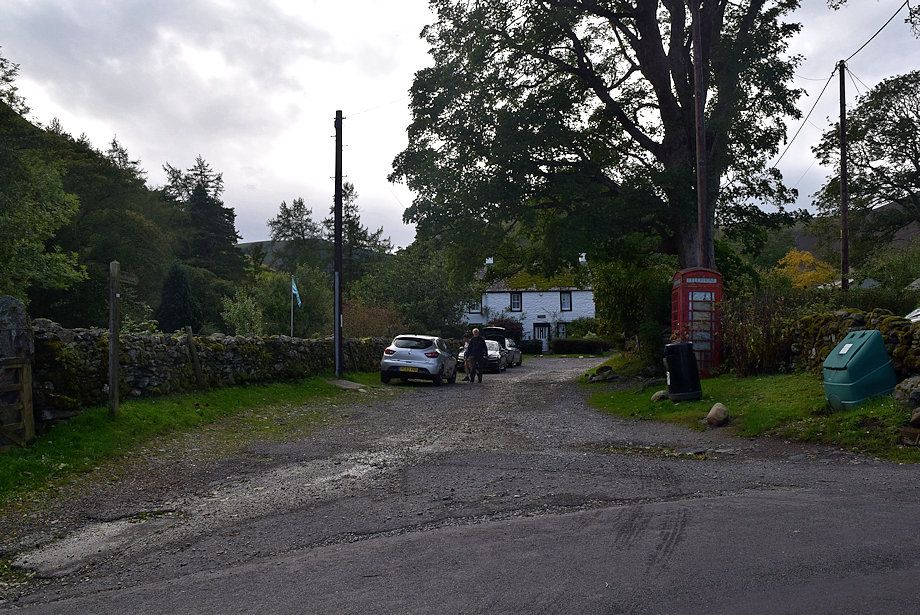
| A short lane by a telephone box, which is a little over a third of a mile from Mungrisdale Village Hall, is the most convenient parking place for this walk |
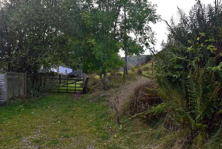 |
| A quarter of a mile from the parking area, shortly after passing the church, a gate which is opposite a minor road junction and to the left of a waterworks building, gives access to a track which leads up to the valley of Bullfell Beck |
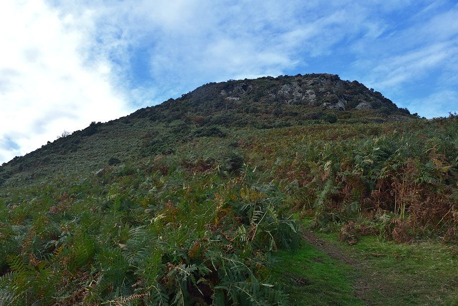 |
| Leave the track and cross a pasture field to the left of a small disused quarry and follow a distinct path towards the southern flank of Raven Crags at the end of Bowscale Fell's east ridge |
 |
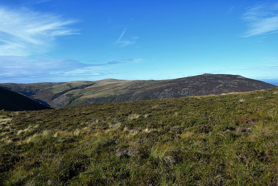
| Looking over to The Tongue, a subsiduary ridge of Bowscale Fell |
 |
| Looking back to the start of the walk from the base of Raven Crags, the waterworks building can be seen in the centre of the photo |
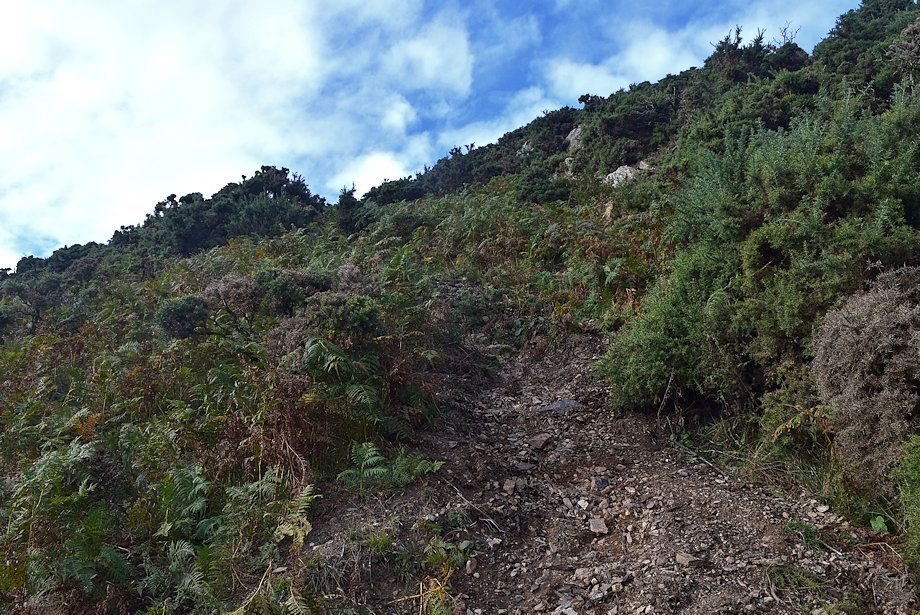 |
| The path leading up to the ridge-line is very steep as it zig-zags through thickets of gorse bushes |
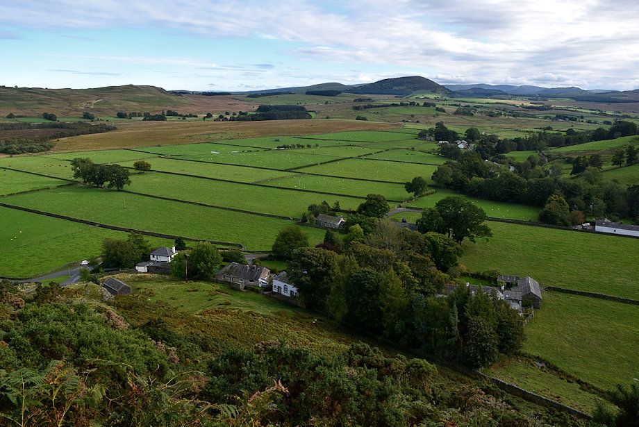 |
| Mungrisdale from the Raven Crags path, the church can be seen in the centre of the photo |
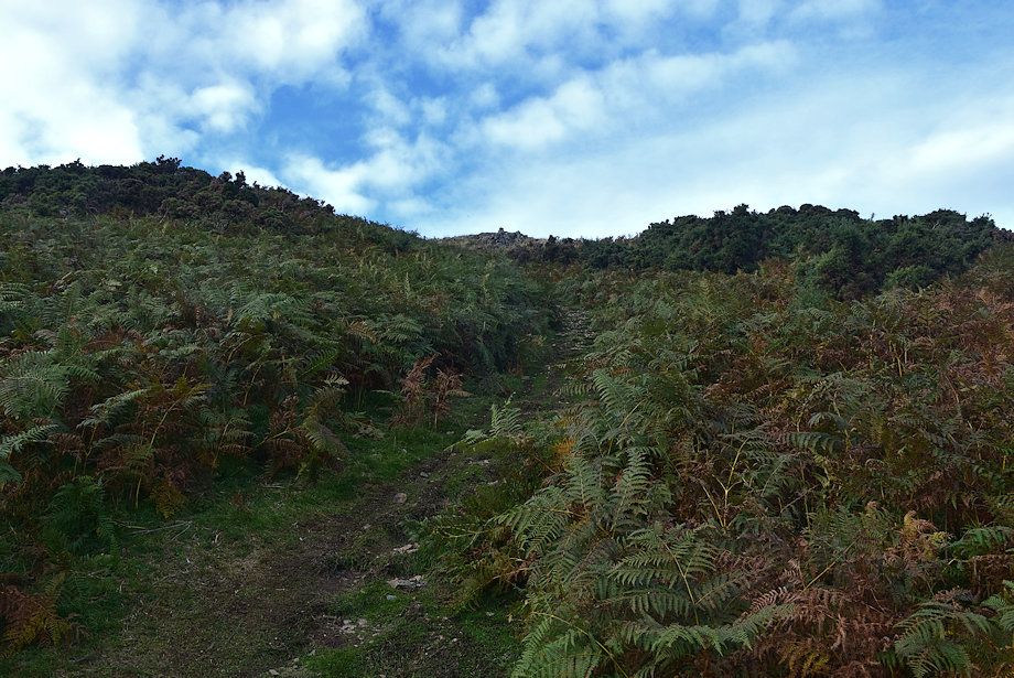 |
| Approaching the top of Raven Crags where the path emerges onto a much more pleasant grass and heather slope |
 |
| Souther Fell from the top of Raven Crags |
 |
| Mungrisdale from the top of Raven Crags with Little Mell Fell and Great Mell Fell on the centre skyline |
 |
| The Glenderamackin Valley flanked by Souther Fell and The Tongue, Blencathra appears over the summit of Bannerdale Crags |
 |
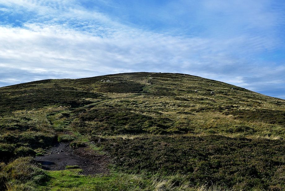
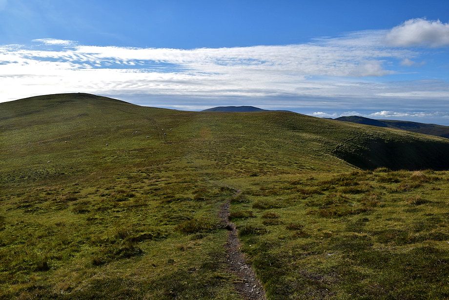
| The path reaches the ridge-line and begins to climb over two distinct, but unnamed tops, on the way to the summit of Bowscale Fell |
 |
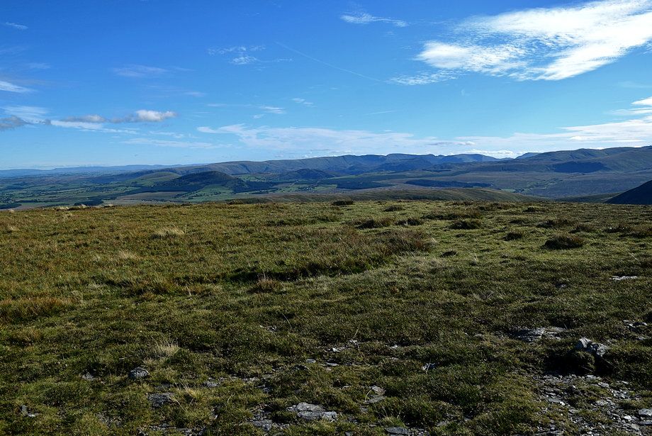
| The Far Eastern and The Eastern Fells form the horizon |
 |
| Looking back to the top of Raven Crags. In the middle distance is Eycott Hill, a Nature Reserve which is also designated as a Site of Special Scientific Interest due to its exposed lava flows |
 |
| To the north the summit of Carrock Fell appears over the ridge |
 |
| Looking south The Eastern Fells appear over Souther Fell as the gradient of the path eases off .......... |
 |
| ......... before it resumes its climb towards the first unnamed top on the ridge |
 |
| Looking over to High Pike and Carrock Fell |
 |
| Looking back from the path to the first unnamed top on the east ridge |
 |
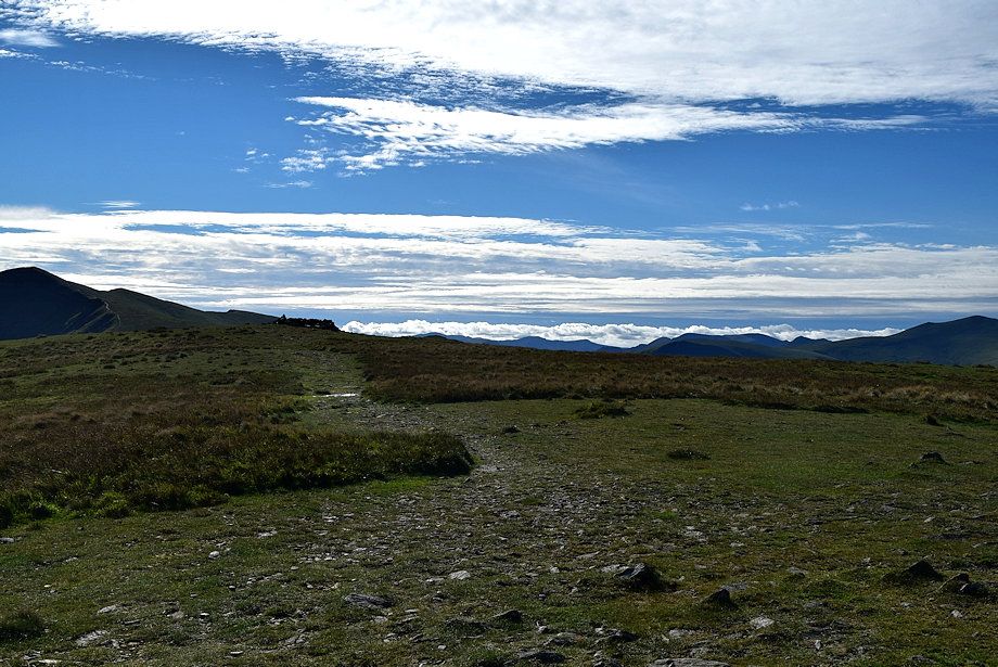
| On reaching a cairn the summit of Bowscale Fell comes into view on the left |
 |
| Approaching the summit of the first unnamed top. The second top on the ridge lies straight ahead, although not named on the map, it is commonly called the East Top by fellwalkers |
 |
| The Caldew River Valley from the summit of the first unnamed top |
 |
| Continuing on, the path dips gently to a col before resuming its climb towards the East Top |
 |
| High Pike and Carrock Fell from the col |
 |
| The path rising to the East Top |
 |
| Looking back to the first unnamed top from the climb to the East Top |
 |
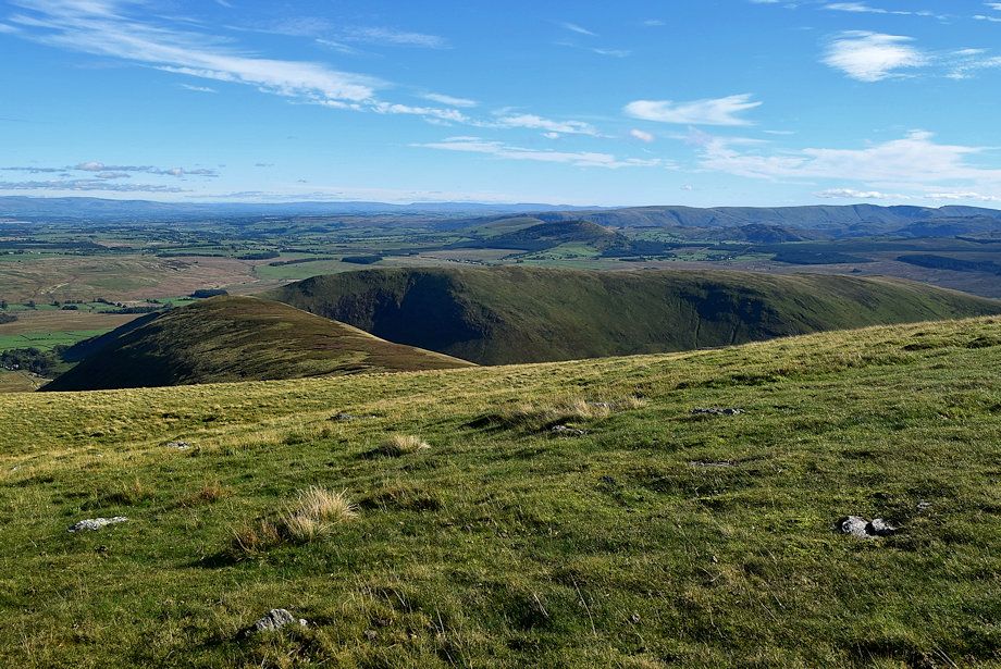
| The Far Eastern Fells across the ridges of Souther Fell and The Tongue |
 |
| Looking down on the hamlet of Mosedale at the foot Carrock Fell |
 |
| The path leads up to a prominent cairn which sits on the edge of the broad summit of the East Top |
 |
| Carrock Fell from the climb to the East Top |
 |
| High Pike from the climb to the East Top |
 |
| Looking over to Blencathra |
 |
| Looking back from the prominent cairn on the East Top |
 |
| The Eastern Fells over Mousethwaite col from the prominent cairn on the East Top |
 |
| The summit of the East Top lies a little over a hundred yards from the prominent cairn |
 |
| The summit cairn on the East Top |
 |
| The Far Eastern Fells from the summit of the East Top |
 |
| The Eastern Fells on the centre horizon with the summit of Bannerdale Crags in the middle distance to the right |
 |
| High Pike from the summit of the East Top |
 |
| Knott, the highest of Back o' Skiddaw Fells from the summit of the East Top |
 |
| The path from the East Top descends to a shallow col which overlooks Bowscale Tarn |
 |
| Approaching the col |
 |
| Looking back to the East Top from the col |
 |
| Knott across Tarn Crags from the col |
 |
| Carrock Fell from the col |
 |
| Bowscale Tarn from the col |
 |
| From the col the path gradually turns to the south-west heading for the summit of Bowscale Fell |
 |
| Looking back to the East Top from the path to the summit |
 |
| The path leading up to the summit of Bowscale Fell |
 |
| Knott from the path to the summit |
 |
| Looking back along the full length of the east ridge |
 |
| The Tongue and Souther Fell from the path to the summit of Bowscale Fell |
 |
| Approaching the summits north cairn which marks a fine viewpoint |
 |
| The north cairn looking towards High Pike and Carrock Fell |
 |
| The Far Eastern Fells and The Eastern Fells with Bannerdale Crags in the middle distance from the north cairn |
 |
| Blencathra from the north cairn |
 |
| Knott from the north cairn |
 |
| High Pike from the north cairn |
 |
| The summit wind shelter lies just 90 yards south-west from the north cairn |
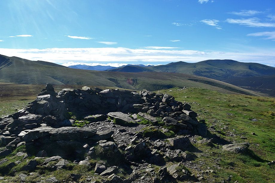 |
| The summit wind shelter on Bowscale Fell |
 |
| The Western Fells of Pillar, Scoat Fell, High Stile and Red Pike appear on the horizon in the centre of the photo |
 |
| Skiddaw from the summit of Bowscale Fell |
 |
| Great Calva and Knott from the summit of Bowscale Fell |
 |
| High Pike from the summit of Bowscale Fell |
 |
| Carrock Fell and the north cairn from the summit of Bowscale Fell |
 |
| The Tongue and Souther Fell from the summit of Bowscale Fell |
 |
| Bannerdale Crags from the summit of Bowscale Fell |
 |
| Blencathra from the summit of Bowscale Fell |
